Showing posts with label snow. Show all posts

Sunday, 12 May 2013

More snow on the Drakensberg.

This is our third or fourth snow fall on the Berg this winter, and winter hasn't really started yet. Must be global warming, I mean climate change, to be PC.

On Friday on Saturday we had heavy, almost non-stop rain, for 24 hrs, rain at this time of the year means snow on the Berg.


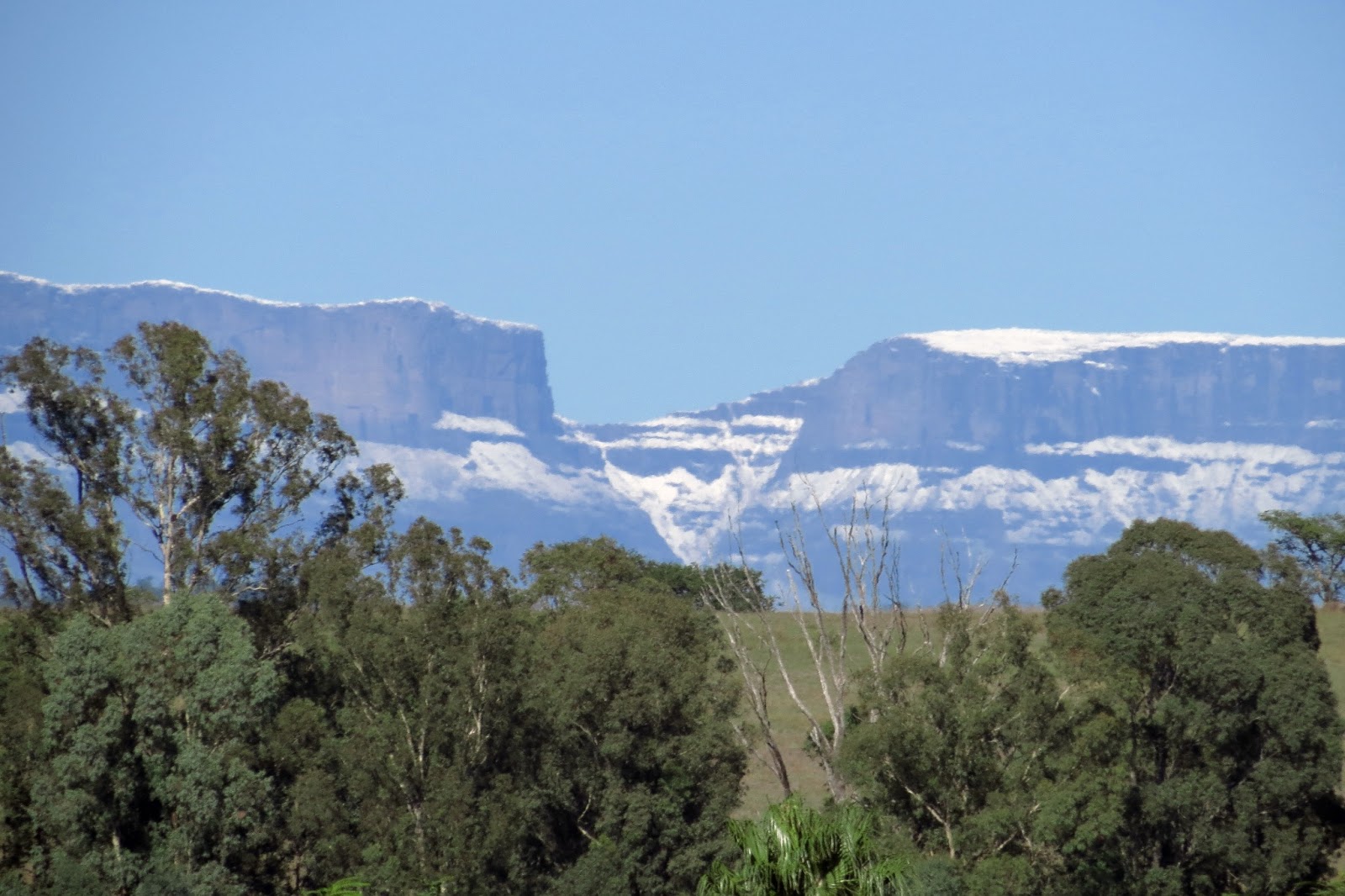
Looking west, a photo of snow on part of the Berg. Looks as if there is enough snow up there, (10,000 feet +) to ski, just don't ski over the edge. The farm in the foreground is the neighbouring farm just to the east of where I live. As you can see I live very close to the Berg.


Same scene just zoomed in a bit. 

I took about 30 photos and every where you look you see trees. South Africans are great tree planters, the Worlds largest man-made forest is in SA, and this forest is planted in our largest city, (strange as it may seem) Johannesburg and it's suburbs. Other cities in SA are not far behind, Pretoria,(the administrative capital)* is known for it's hundreds of thousands of Jacaranda trees, a sight to behold in October when the whole city turns purple.

*South Africa has three capitals, (not counting provincial capitals, 11 of them) Cape Town the parliamentary capital - parliament meets there-, Pretoria the administrative capital, and Bloemfontein the judicial capital, seat of the *Supreme court.

* Supreme court, not the same thing as the US supreme court, our equivalent the US Supreme court is our Constitutional court.


Thursday, 4 April 2013

Snow on the Berg.

We had rain again yesterday, lots of rain, (I'm thinking of moving somewhere drier, like British Columbia, or one of the NW Pacific coastal states of the US, like Washington state) with it came a sudden drop in temperature. Woke up this morning and it was freezing. 

Went to school to do some work in the library, and we have a lovely view of parts of the Berg, (not called Drakensview school for nothing) and I snapped these photos.

Click to enlarge.


Snow in April, and it's still snowing in parts of the Northern hemisphere! Must be this global warming thing. View of Giants Castle with a light dusting of snow.


View of the Berg just a bit north of Giants Castle, slightly more snow. Our first snows usually only fall towards the end of May, so this is very early. Because of all the rain we've had people have been predicting a very cold winter this year. Who knows maybe they are right.

Thursday, 1 November 2012

More pics of the house and about the weather.

Tuesday afternoon we were hit by gale force winds that continued right through the night and for most of Wednesday, for a while I thought hurricane Sandy had lost it's way. This morning the Berg was covered in snow and winter was back. At the moment a cold rain is falling, according to the weather people we have had more than three times the usual amount of rain for October.

Click to enlarge.


My new back yard, actually I share it with four other households. My cottage is just to the right of the swimming pool. The swimming pool has a net over it as there are a couple of small children here and it's only removed when there is adult supervision.


The front of the cottage, excuse all the untidiness outside . The pointy bit sticking out behind the cottage is the thatched roof of the "lapa", it has a back wall, place for a braai, BBq, and is an outdoor entertainment area next to the pool. I will post some photos of it later so you can see what it looks like.

Monday, 10 September 2012

More snow.

The cold front and almost 48 hours of continuous rain last week, also dumped a huge amount of snow on the Berg. I was only able to take these photos this morning as the Berg has been covered by a hazy cloud since Friday when it stopped raining, so some of the snow had already melted. 

Click to enlarge.


I took several photos to make two panoramas. The one above shows Giants Castle on the far left, (the southern end of this photo). 


This one shows more of the Central Berg.


Zoomed in shot of Giants Castle, 3000 meters. Some of my favourite fishing spots lie about 15km from the foot of Giants castle and it takes me almost an hour, on good roads, to get there. Gives you an idea of how far away I was when I took this photo.

 Behind Giants Castle the Berg turns inland in South Westerly direction, then after more than a hundred kilometres turns southward again for several hundred more kilometres.


Snow on part of the central Berg at 3000 meters plus.


More towards the north, these trees in the foreground are about 45km from the mountain. Another cold front has moved in this afternoon after a balmy spring day when I went to work in a short sleeved shirt. 

Sunday, 15 July 2012

First snow of the year.

The predicted cold front was no myth and the Drakensberg has had it's first snow of the year, hopefully not the last. Snow melt keeps the rivers flowing before the first spring rains arrive, useful to have enough water if you wish to do a bit of fly fishing. Unfortunately the southern part of the country had freezing weather and too much snow making roads impassible, and torrential rains which caused flooding ans extensive damage.


Click to enlarge.


Weather satellite photo showing the tail end of the cold front passing to the east. The area from about 29* south latitude was affect very badly.  


Tried to take some photos of the snow on the Berg but the light was bad, (midday, very bright) but with a bit of manipulation I did manage.


This is a photo of the northern spur of 'NtabamHlophe, (height about 2000m above sea level), otherwise known as White mountain. ('Ntabam = mountain & Hlophe = white) The Berg & snow can be see behind. 'NtabamHlophe is about 24km from where I stood to take the photo, the Berg behind another +- 10km.


This photo is two photos "stitched" together to create a bit of a panorama.


Well our three week, mid year, winter holiday come to a halt and tomorrow is back to school.


Monday, 15 August 2011

Freezing cold.

Another cold front passed through this week end dumping loads of snow on the Berg and heavy rain. So far we have had four snowfalls on the Drakensberg this year, most years it's only two, sometimes only one. The N3 highway was once again closed for several hours. 


These cold fronts always seem to pick the week ends. I've been living in Estcourt permanently since 1993 and I can't remember it ever being so cold. Long time residents and people born here say it's the coldest in more than thirty years. So much for global warming. I suppose the "experts" will tell us it's because of global warming that the winters are so cold!


But the sky cleared late this afternoon and the sunset promised good weather for tomorrow.


Another cold front is predicted for this Friday. 

Wednesday, 27 July 2011

Return to normal

Woke up this morning and the cold front was a thing of the past. Still cold but not as bad as the previous two days. The mountains around Estcourt, in an arc of about 250 degrees, were covered with snow, and with the crisp clear air they seemed so close you felt you just had to reach out and you could touch them.  A stunning sight. The Drakensberg range for about 800km, from Berkley East, in the south to Newcastle in the north, was covered in heavy snow.


The N3 highway which was closed for 24 hours, opened at 10am this morning, after the ice on the road had melted. Yesterday there were trucks and cars backed up for 30km at both ends. Today it's traffic as usual, actually more than usual, as all the transport backlog has to be caught up.


Click on photos to enlarge.


Took this photo on my way to work this morning at 06h50, of just a small section of the Drakensberg. The sun is coming up behind me and the suns rays are just lighting up the snow covered slopes of the Drakensberg. My cottage is just a couple of hundred metres to the right of the mobile phone tower seen just to the right of the road.


Took this photo at about 08h20 from the staff room window, overlooking the junior primary play grounds. The Drakensberg can be seen just behind the rise. The children out enjoying the early morning sunshine, after being confined to the classrooms for two days.


Sunset promising another beautiful day tomorrow.


Fortunately for us our bad weather never lasts long, winter just lest us know now and again who is in control.

Tuesday, 26 July 2011

Winter with a vengeance 2.

Well the weather Sangoma's  (Witch Doctors) weren't kidding when they predicted severe weather. Sometimes when they throw the bones to predict the weather they get it right.


Today's maximum temperature on the sattelite photo below.


The photo below shows the minimum temperatures for today. Estcourt lies right in the dark blue patch, just to the east of Lesotho.

Satelite photo below shows the cold front where it was at 15:00 today, slowly moving east over the Indian Ocean. The weather should be clearing from tomorrow, but another cold front is expected on Friday. Too much of a good thing maybe?


The N3 highway was closed at Van Reenens Pass, where the highway goes over the Drakensberg, heading north to Johannesburg and other major centres. This is the highway that passes behind my cottage, strange to see it so quiet. Fifty percent of South Africa's exports and imports are transported along this route.


The following photos I took this afternoon after school between 14h00 and 15h00.


Rode out of town on route R103, east, southeast, on the road to Mooi River to the top of Griffins Hill as distance of about 9km and took the following photos. Griffins Hill is about 150 metres higher than Estcourt.


It was freezing cold up here with a strong wind blowing.


If you enlarge the photo above you might just make out a farmers pickup truck driving through the snow, the truck is a silvery grey colour, which makes it hard to spot. Looking for missing livestock maybe?


Parked on the opposite side of the road, was an Indian father and his two sons, from Estcourt. The sons had convinced their father to take the to see the snow. Snow is a novelty to us, often falls on the high ground but not so near to town. Half the town was out looking at the snow. 


Taken in town looking towards the Drakensberg. Enlarge the photo by clicking on it and the mountains can be seen just under the clouds.


The mountain centre right of the picture, with snow cap, is NtabamHlophe, isZulu for White mountain. Took this photo just before I turned of right onto the farm where I live. This mountain is about 16km from my cottage. The Drakensberg can be seen behind it.


Tombi lying with her head on my foot, while I write this post. Whenever I'm working at the laptop or tying flies this is where she lies, just has to make contact with me.


Made a big pot of bean soup last night, will warm it up for supper tonight. Should keep me warm in more ways than one. 


Weather photos from: www.weatherphotos.co.za

Saturday, 11 June 2011

Monthly trip

The Italian leprechaun and I took our monthly trip to Pietermaritzburg this morning. We travelled in his car, which is a Ford KA. Someone said the other day that it looks like a computer mouse on steriods.


Just before going onto the highway we stopped and I took a couple of photos of the snow on the Drakensberg mountains.


Click on photo to enlarge.


Not the best vantage point from which to take a photo. The front of the Berg is very steep,almost vertical, so not much snow sticks there. On top, which is a plateau, the snow will be several feet deep. On the northern slopes the snow will melt very quickly. Trout fishermen like lots of snow on the Berg, this will mean good stream flows in the spring, making for good fishing.


This photo taken almost from the same position as the one above shows a small section of the lake behind the Wagendrift dam. The dam is built on the spot where ox-wagons used to cross the Bushmans river in the 1800's. Hence the name. (Drift is Afrikaans for a ford)


Interior of the temple of Mammon. One thing that struck me was that the smaller the shop, the less goods it had on display, and the higher the prices. 


We did our shopping, stopped at the Mug & Bean coffee shop, had a good breakfast and their bottomless cup of coffee, served by friendly and efficient waiters. The service can only be described as slick. The food very good and the coffee fantastic.


On the way out I took this photo of a small part of the parking lot. No one drives an old car any more, every car I saw was new. I must be the only person who drives a car older than 5 years.(actually mine is 28 years old). 


In the background you see the hills that surround Pietermaritzburg, covered in plantations of SA Pines and Blue gums. These plantations belong to the municipality. Due to the fact that the town lies in a hollow it gets extremely hot and humid in the summer.


The N3 highway near Lions River. This part of Natal is known as the Midlands.


The last stretch heading home. The Wagendrif dam lies at the bottom of the valley on the left. Turn off to my cottage is on the left at the top, after turning left we turn right over bridge crossing the highway, then it's only a couple of hundred metres, and home.


Wagendrift dam, photo taken as we drove past. Note the uprights of the bridge railings slanted to the right. They are actually vertical. The Italian Leprechaun gave me a physics lesson as to why this happened in the photograph, not that I understood any of it. (I'm a librarian not a mathematician).


Today was one of those perfect winter days we have here in Natal. Blue skies, bright sun and warm. Last week was cold, overcast, with lots of rain, all the staff at school were walking around with long glum faces, complaining about the weather. We are not used to real winters here. I think tonight will be very cold though, clear skies means frost at night.


If tomorrow is like today it means good trout fishing weather. Think I'll bunk church and go fishing, give Mark's wiggle tail flies a try. Starting to feel guilty already, but I think I'll get over it.